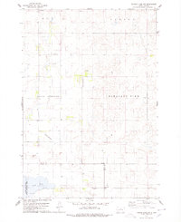
1978 Map of Thomas Lake NW
USGS Topo · Published 1978About this map
Stone Lake sits at the southwestern edge of this landscape, surrounded by the Stone Lake State Public Shooting Area. The terrain is defined by the townships of Roy, Canton, Avon Springs, and Pleasant View, revealing a sparse but organized rural structure during the late 1970s. The map highlights the localized infrastructure of the Dakota plains, featuring small private aviation markers like the Hobus Landing Strip and Fischer Landing Strip. Evidence of early community education remains visible at the Capp Sch site, while numerous gravel pits across the landscape indicate the local industry supporting the region's road network. This survey also documents the convergence of three county lines, where Potter, Sully, and Hyde counties meet.
Find a feature on this map
13 named features on this map. Tap any name to fly to it.
Don’t see what you’re looking for? This feature index may not catch every label — zoom into the map to look around manually.
Map Details
Editions of this 1978 Thomas Lake NW Map
This is the sole edition of this map. No revisions or reprints were ever made.
Other maps of this area

1953 · Huron
USGS Topo · 1:250,000

1954 · Aberdeen
USGS Topo · 1:250,000

1954 · Huron
USGS Topo · 1:250,000

1956 · Aberdeen
USGS Topo · 1:250,000

1974 · Gettysburg Municipal Airport SE
USGS Topo · 1:24,000
1974 · Gettysburg Muni. Airport NE
USGS Topo · 1:24,000
1978 · Bald Hills
USGS Topo · 1:24,000
1978 · Thomas Lake
USGS Topo · 1:24,000
1978 · Thomas Lake SW
USGS Topo · 1:24,000
1978 · Seneca SW
USGS Topo · 1:24,000