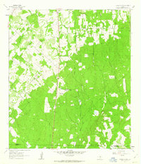
1961 Map of Thomas Springs
USGS Topo · Published 1963About this map
Zion Hill Ch and its adjacent Zion Hill Cem anchor the northern landscape of this rural region on the border of Guadalupe and Wilson Counties. Surveyed in the late 1950s and early 1960s, the terrain is defined by a dense network of drainage systems, including Sandies Creek and the East Fork Ecleto Creek, which carve through the elevations around Kings Hill. Small community clusters like Dugger, Clayton, and Jakes Colony Ch suggest a dispersed agricultural settlement pattern typical of the South Texas brush country before significant modern development.
Find a feature on this map
20 named features on this map. Tap any name to fly to it.
Don’t see what you’re looking for? This feature index may not catch every label — zoom into the map to look around manually.
Map Details
Editions of this 1961 Thomas Springs Map
3 editions found
Other maps of this area

1911 · San Marcos
USGS Topo · 1:125,000

1919 · San Marcos
USGS Topo · 1:125,000

1920 · Smiley
USGS Topo · 1:125,000

1924 · New Braunfels No 4
USGS Topo · 1:48,000

1924 · San Marcos 3-c
USGS Topo · 1:48,000

1924 · San Marcos 3-d
USGS Topo · 1:48,000

1927 · New Braunfels
USGS Topo · 1:62,500

1930 · Seguin
USGS Topo · 1:62,500

1942 · Dewville
USGS Topo · 1:62,500

1953 · Seguin
USGS Topo · 1:250,000