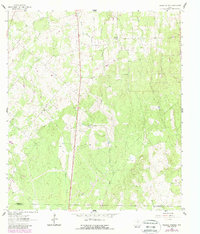
1961 Map of Thomas Springs
USGS Topo · Published 1987About this map
Zion Hill and Jakes Colony anchor this rural landscape in southeastern Guadalupe County, showing the distribution of small community centers in the early 1960s. The map captures a transition between the elevated terrain of Kings Hill and the drainage basins of Ecleto Creek and Sandies Creek. Notable for genealogists and local historians, the sheet records specific sites such as the Zion Hill Ch and its adjacent Zion Hill Cem, as well as the Jakes Colony Ch further west.
Find a feature on this map
23 named features on this map. Tap any name to fly to it.
Don’t see what you’re looking for? This feature index may not catch every label — zoom into the map to look around manually.
Map Details
Editions of this 1961 Thomas Springs Map
3 editions found
Other maps of this area

1911 · San Marcos
USGS Topo · 1:125,000

1919 · San Marcos
USGS Topo · 1:125,000

1920 · Smiley
USGS Topo · 1:125,000

1924 · New Braunfels No 4
USGS Topo · 1:48,000

1924 · San Marcos 3-c
USGS Topo · 1:48,000

1924 · San Marcos 3-d
USGS Topo · 1:48,000

1927 · New Braunfels
USGS Topo · 1:62,500

1930 · Seguin
USGS Topo · 1:62,500

1942 · Dewville
USGS Topo · 1:62,500

1953 · Seguin
USGS Topo · 1:250,000