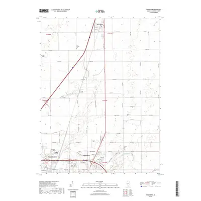
2018 Map of Thomasboro
USGS Topo · Published 2018About this map
Thomasboro stands at the northern edge of this Illinois prairie landscape, where the structured grid of the Public Land Survey System meets the expanding northern reaches of Urbana and Champaign. This 2018 survey reveals a territory defined by agricultural heritage and modern transportation corridors, with the rural hamlet of Leverett situated between the larger municipal centers. The map provides significant detail for genealogists, identifying several local burial grounds including Saint Elizabeth Cem, Yearsley Cem, and Clements Cem, which reflect the area's long-established farming communities.
Find a feature on this map
56 named features on this map. Tap any name to fly to it.
Don’t see what you’re looking for? This feature index may not catch every label — zoom into the map to look around manually.
Map Details
Editions of this 2018 Thomasboro Map
This is the sole edition of this map. No revisions or reprints were ever made.
Other maps of this area

1906 · Urbana
USGS Topo · 1:62,500

1907 · Mahomet
USGS Topo · 1:62,500

1924 · Paxton
USGS Topo · 1:62,500

1927 · Paxton
USGS Topo · 1:62,500

1928 · Gibson City
USGS Topo · 1:62,500

1949 · Paxton
USGS Topo · 1:62,500

1957 · Urbana
USGS Topo · 1:62,500

1957 · Paxton
USGS Topo · 1:62,500

1957 · Gibson City
USGS Topo · 1:62,500

1957 · Urbana
USGS Topo · 1:24,000