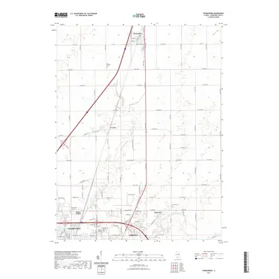
2021 Map of Thomasboro
USGS Topo · Published 2021About this map
Thomasboro sits at the northern edge of this Illinois prairie landscape, where the grid of rural county roads meets the expanding urban reach of Champaign and Urbana. This transition from agriculture to aviation and suburban development is marked by landmarks like Frasca Field and the Lincoln Memorial Gardens, alongside older community anchors such as Saint Elizabeth Cem and Yearsley Cem. The map reveals the importance of drainage in this flat terrain, notably the Saline Br Drainage Ditch which cuts across the southeastern sector near Augerville. Smaller settlements like Leverett and Wilbur Heights illustrate the historical clusters that formed around crossroads and transportation corridors before the modern regional expansion. The detailed road network, including N Cunningham Ave and numerous numbered county roads like Co RD 33, underscores the area's role as a vital connection point between the surrounding farmland and the university city hub.
Find a feature on this map
89 named features on this map. Tap any name to fly to it.
Don’t see what you’re looking for? This feature index may not catch every label — zoom into the map to look around manually.
Map Details
Editions of this 2021 Thomasboro Map
This is the sole edition of this map. No revisions or reprints were ever made.
Other maps of this area

1906 · Urbana
USGS Topo · 1:62,500

1907 · Mahomet
USGS Topo · 1:62,500

1924 · Paxton
USGS Topo · 1:62,500

1927 · Paxton
USGS Topo · 1:62,500

1928 · Gibson City
USGS Topo · 1:62,500

1949 · Paxton
USGS Topo · 1:62,500

1957 · Urbana
USGS Topo · 1:62,500

1957 · Paxton
USGS Topo · 1:62,500

1957 · Gibson City
USGS Topo · 1:62,500

1957 · Urbana
USGS Topo · 1:24,000