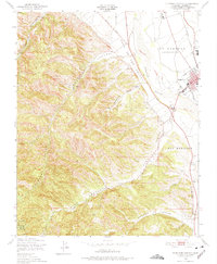
1949 Map of Thompson Canyon
USGS Topo · Published 1978About this map
King City sits as the primary settlement on the eastern edge of this 1949 landscape, where the valley floor meets the complex drainage systems of the Gabilan Range. The map details the transition from the agricultural flats along the Salinas River to the steep, dissected terrain characterized by Thompson Canyon and Monroe Canyon. Infrastructure of the era is well-represented, from the Southern Pacific railroad line and Central Avenue to the King City Airport and local utilities like a Pumping Sta and Sewage Disposal site.
Find a feature on this map
19 named features on this map. Tap any name to fly to it.
Don’t see what you’re looking for? This feature index may not catch every label — zoom into the map to look around manually.
Map Details
Editions of this 1949 Thompson Canyon Map
4 editions found
Other maps of this area

1912 · Metz
USGS Topo · 1:31,680

1915 · Soledad
USGS Topo · 1:62,500

1919 · King City
USGS Topo · 1:62,500

1919 · Junipero Serra
USGS Topo · 1:62,500

1921 · Metz
USGS Topo · 1:62,500

1939 · King City
USGS Topo · 1:62,500

1940 · Metz
USGS Topo · 1:62,500

1940 · Soledad
USGS Topo · 1:62,500

1941 · Junipero Serra
USGS Topo · 1:62,500

1947 · Metz
USGS Topo · 1:62,500