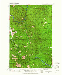
1935 Map of Thompson Lakes
USGS Topo · Published 1961About this map
The Kootenai River snakes through the mountainous terrain of the Kootenai National Forest, serving as a vital corridor for the Great Northern Railway as it follows the river’s bend toward Jennings. This mid-1930s survey illustrates a landscape defined by timber and mineral extraction, most notably at the Vermiculite Mine near Vermiculite Mtn. Settlements like Warland and Fleetwood dot the northern reaches, while the southern valleys are characterized by isolated educational outposts and forestry management sites.
Find a feature on this map
95 named features on this map. Tap any name to fly to it.
Don’t see what you’re looking for? This feature index may not catch every label — zoom into the map to look around manually.
Map Details
Editions of this 1935 Thompson Lakes Map
3 editions found
Other maps of this area

1913 · Stryker
USGS Topo · 1:125,000

1916 · Stryker
USGS Topo · 1:125,000

1920 · Libby
USGS Topo · 1:125,000

1920 · Jennings
USGS Topo · 1:125,000

1930 · Libby
USGS Topo · 1:125,000

1932 · Libby
USGS Topo · 1:125,000

1932 · Trout Creek
USGS Topo · 1:125,000

1935 · Thompson Lakes
USGS Topo · 1:96,000

1935 · Trout Creek
USGS Topo · 1:125,000

1936 · Trout Creek
USGS Topo · 1:125,000