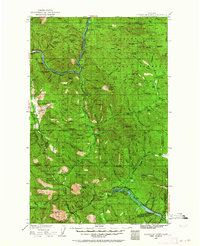
1935 Map of Thompson Lakes
USGS Topo · Published 1964About this map
The Kootenai River snakes through the northwest corner of this mid-1930s survey, dictating the path of the Great Northern Railway as it passes through the small settlement of Warland. This landscape is defined by the heavy timber of the Kootenai National Forest, where a network of remote outposts like the Raven Ranger Sta and Fairview Guard Sta supported forest management in a time when mountain peaks served as critical lookout points.
Find a feature on this map
118 named features on this map. Tap any name to fly to it.
Don’t see what you’re looking for? This feature index may not catch every label — zoom into the map to look around manually.
Map Details
Editions of this 1935 Thompson Lakes Map
3 editions found
Other maps of this area

1913 · Stryker
USGS Topo · 1:125,000

1916 · Stryker
USGS Topo · 1:125,000

1920 · Libby
USGS Topo · 1:125,000

1920 · Jennings
USGS Topo · 1:125,000

1930 · Libby
USGS Topo · 1:125,000

1932 · Libby
USGS Topo · 1:125,000

1932 · Trout Creek
USGS Topo · 1:125,000

1935 · Thompson Lakes
USGS Topo · 1:96,000

1935 · Trout Creek
USGS Topo · 1:125,000

1936 · Trout Creek
USGS Topo · 1:125,000