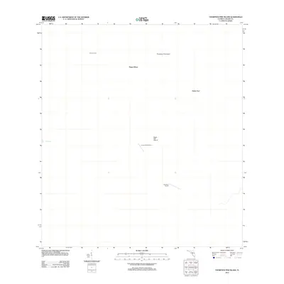
2012 Map of Thompson Pine Island
USGS Topo · Published 2012About this map
Osceolas Camp sits in the northern reaches of this Florida landscape, a region characterized by distinctive named terrain features like Thompson Pine Island and the evocatively named Wagon Wheel. Aviation history in this part of Collier County is marked by remote airstrips such as the Calusa Ranch Airport and Little Deer Airport, reflecting the logistical needs of managing large tracts of land. The presence of Sugar Mill Mound suggests a point of historical or archaeological interest, while the eastern portion of the survey is dominated by the Turkey Foot area. Near the western edge, Mud Lake provides one of the few named water features in an area otherwise defined by its subtle topographic rises and flat expanses. This 2012 survey by the U.S. Geological Survey provides a precise record of these landmarks before further development or environmental shifts altered the character of the Big Cypress region.
Find a feature on this map
8 named features on this map. Tap any name to fly to it.
Don’t see what you’re looking for? This feature index may not catch every label — zoom into the map to look around manually.
Map Details
Editions of this 2012 Thompson Pine Island Map
This is the sole edition of this map. No revisions or reprints were ever made.
Other maps of this area

1956 · Miami
USGS Topo · 1:250,000

1956 · West Palm Beach
USGS Topo · 1:250,000

1957 · West Palm Beach
USGS Topo · 1:250,000

1958 · West Palm Beach
USGS Topo · 1:250,000

1958 · Miami
USGS Topo · 1:250,000

1972 · Monroe Station NE
USGS Topo · 1:24,000

1972 · Burns Lake
USGS Topo · 1:24,000

1973 · North Of Fiftymile Bend
USGS Topo · 1:24,000

1974 · Immokalee 4 NW
USGS Topo · 1:24,000
1974 · Immokalee 4 SW
USGS Topo · 1:24,000