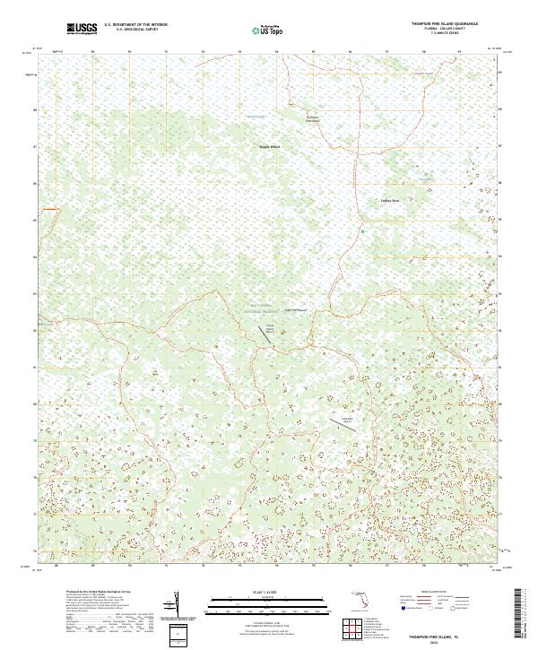
2024 Map of Thompson Pine Island
USGS Topo · Published 2024About this map
Big Cypress National Preserve encompasses most of this South Florida landscape, where the wetland environments of the Everglades transition through strands and sloughs. Historically significant landmarks such as Sugar Mill Mound indicate early human presence in the region, while named locations like Wagon Wheel and Turkey Foot suggest the local vernacular of hunters and early settlers. The terrain is a complex network of seasonal water and elevated islands, including Thompson Pine Island and the Bamboo Strand. Transportation in this interior wilderness is defined by a dense web of primitive routes, including the Florida National Scenic Trl and specialized paths like the Raccoon Point Trl. Small landing strips, Calusa Ranch Airport and Little Deer Airport, provide remote access to these preserves.
Find a feature on this map
27 named features on this map. Tap any name to fly to it.
Don’t see what you’re looking for? This feature index may not catch every label — zoom into the map to look around manually.
Map Details
Editions of this 2024 Thompson Pine Island Map
This is the sole edition of this map. No revisions or reprints were ever made.
Other maps of this area

1956 · Miami
USGS Topo · 1:250,000

1956 · West Palm Beach
USGS Topo · 1:250,000

1957 · West Palm Beach
USGS Topo · 1:250,000

1958 · West Palm Beach
USGS Topo · 1:250,000

1958 · Miami
USGS Topo · 1:250,000

1972 · Monroe Station NE
USGS Topo · 1:24,000

1972 · Burns Lake
USGS Topo · 1:24,000

1973 · North Of Fiftymile Bend
USGS Topo · 1:24,000

1974 · Immokalee 4 NW
USGS Topo · 1:24,000
1974 · Immokalee 4 SW
USGS Topo · 1:24,000