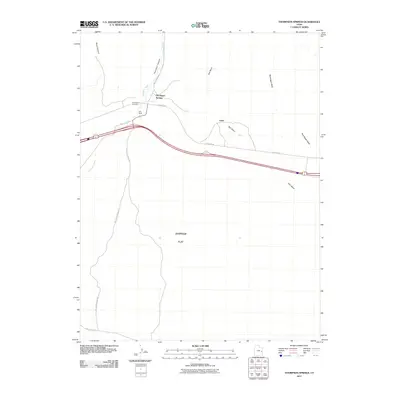
2011 Map of Thompson Springs
USGS Topo · Published 2011About this map
Thompson Springs serves as the primary settlement on this high-desert landscape in Grand County, where the infrastructure of the interstate era overlays older transportation routes. The community is situated at the mouth of Thompson Canyon, with the Thompson Cemetery and Ute Field located nearby along the frontage. The map illustrates a drainage network dominated by several significant washes, including Thompson Wash, Bootlegger Wash, and Salt Wash, which carve through the arid terrain. To the south, the expansive Whipsaw Flat spreads out toward Salt Valley Gorge Rd. The presence of the rail line and proximity to canyon access points like Blaze Canyon highlights the area's role as a transit corridor. Further east, the small settlement of Vista is noted along the highway, marking a sparse distribution of development common in this part of eastern Utah.
Find a feature on this map
15 named features on this map. Tap any name to fly to it.
Don’t see what you’re looking for? This feature index may not catch every label — zoom into the map to look around manually.
Map Details
Editions of this 2011 Thompson Springs Map
This is the sole edition of this map. No revisions or reprints were ever made.
Other maps of this area

1885 · East Tavaputs
USGS Topo · 1:250,000

1885 · La Sal
USGS Topo · 1:250,000

1956 · Moab
USGS Topo · 1:250,000

1956 · Grand Junction
USGS Topo · 1:250,000

1958 · Crescent Junction
USGS Topo · 1:62,500

1958 · Thompson
USGS Topo · 1:62,500

1959 · Grand Junction
USGS Topo · 1:250,000

1959 · Moab
USGS Topo · 1:250,000

1960 · Moab
USGS Topo · 1:250,000

1960 · Grand Junction
USGS Topo · 1:250,000