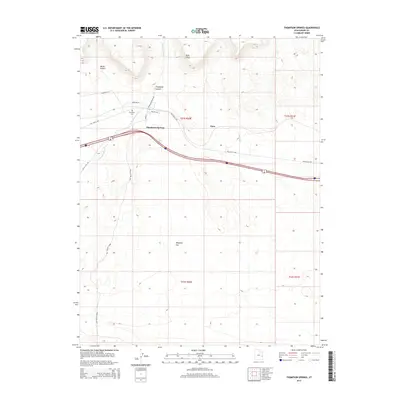
2014 Map of Thompson Springs
USGS Topo · Published 2014About this map
Thompson Springs serves as a central point of reference in this high-desert landscape, positioned where the southern edge of the Book Cliffs meets the expansive plains of Grand County. The town is tied to the transit corridors of the Old Cisco Hwy and the modern interstate, while local history is anchored by the Thompson Cem and streets like Main St. To the north, the terrain is defined by deep incisions such as Blaze Canyon and Thompson Canyon, through which Thompson Wash descends toward the flats. South of the settlement, the geography opens into the broad expanse of Whipsaw Flat and the dramatic depression of the Salt Valley Gorge. This survey provides a clear view of the transition between the high mesa escarpments and the desert floor, showing the network of local thoroughfares including Valley City Rd and Railroad Rd that connect these remote canyon mouths.
Find a feature on this map
20 named features on this map. Tap any name to fly to it.
Don’t see what you’re looking for? This feature index may not catch every label — zoom into the map to look around manually.
Map Details
Editions of this 2014 Thompson Springs Map
This is the sole edition of this map. No revisions or reprints were ever made.
Other maps of this area

1885 · East Tavaputs
USGS Topo · 1:250,000

1885 · La Sal
USGS Topo · 1:250,000

1956 · Moab
USGS Topo · 1:250,000

1956 · Grand Junction
USGS Topo · 1:250,000

1958 · Crescent Junction
USGS Topo · 1:62,500

1958 · Thompson
USGS Topo · 1:62,500

1959 · Grand Junction
USGS Topo · 1:250,000

1959 · Moab
USGS Topo · 1:250,000

1960 · Moab
USGS Topo · 1:250,000

1960 · Grand Junction
USGS Topo · 1:250,000