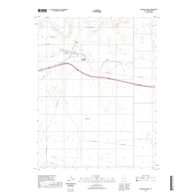
2020 Map of Thompson Springs
USGS Topo · Published 2020About this map
Thompson Springs serves as the focal point for this high-desert landscape in Grand County, where the transition from the Whipsaw Flat lowlands to the striking Book Cliffs escarpment defines the local geography. The map illustrates a complex transportation history, with modern routes paralleled by the Old Railroad Rd and Old Hwy Cisco, tracing the movement of people and goods through this corridor over many decades. Local genealogists will find the Thompson Springs Cem noted just north of the town center, near the junction of Thompson Cyn Rd and Sego Cyn Rd. The drainage systems, particularly Thompson Wash, have carved out distinct landmarks like Blaze Canyon and Thompson Canyon, providing a detailed look at the natural features that historically dictated where roads and settlements like Vista could be established.
Find a feature on this map
20 named features on this map. Tap any name to fly to it.
Don’t see what you’re looking for? This feature index may not catch every label — zoom into the map to look around manually.
Map Details
Editions of this 2020 Thompson Springs Map
This is the sole edition of this map. No revisions or reprints were ever made.
Other maps of this area

1885 · East Tavaputs
USGS Topo · 1:250,000

1885 · La Sal
USGS Topo · 1:250,000

1956 · Moab
USGS Topo · 1:250,000

1956 · Grand Junction
USGS Topo · 1:250,000

1958 · Crescent Junction
USGS Topo · 1:62,500

1958 · Thompson
USGS Topo · 1:62,500

1959 · Grand Junction
USGS Topo · 1:250,000

1959 · Moab
USGS Topo · 1:250,000

1960 · Moab
USGS Topo · 1:250,000

1960 · Grand Junction
USGS Topo · 1:250,000