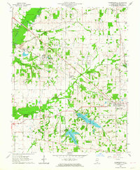
1963 Map of Thompsonville
USGS Topo · Published 1964About this map
The industrial and rural character of Franklin County is clearly defined in this early 1960s survey, particularly where the Illinois Central railroad cuts through the terrain. The coal mining history of the region is anchored by the Orient No 5 Mine and associated infrastructure like the Tailings Pond and Pumphouse, reflecting the extractive economy that shaped southern Illinois. Small settlements like Parrish, Akin, and Hanaford appear alongside a dense network of family and community landmarks, including Swofford Cem and Antioch Ch. The landscape is further shaped by water management and resource extraction, with numerous Oil Well symbols dotting the landscape near Thompsonville and the significant footprint of the West Frankfort City Lake and West Frankfort Reservoir to the south. This map captures the transition between organized coal operations and the quiet, cemetery-dotted agricultural townships of Ewing and Benton.
Find a feature on this map
53 named features on this map. Tap any name to fly to it.
Don’t see what you’re looking for? This feature index may not catch every label — zoom into the map to look around manually.
Map Details
Editions of this 1963 Thompsonville Map
2 editions found
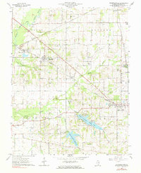
Other maps of this area

1908 · Galatia
USGS Topo · 1:62,500

1909 · West Frankfort
USGS Topo · 1:62,500

1938 · Galatia
USGS Topo · 1:62,500

1939 · Ina
USGS Topo · 1:62,500

1941 · West Frankfort
USGS Topo · 1:62,500

1942 · McLeansboro
USGS Topo · 1:62,500

1943 · Ina
USGS Topo · 1:62,500

1945 · McLeansboro
USGS Topo · 1:62,500

1949 · Paducah
USGS Topo · 1:250,000

1950 · Paducah
USGS Topo · 1:250,000