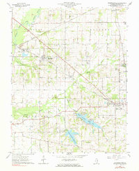
1963 Map of Thompsonville
USGS Topo · Published 1964About this map
The Illinois Central railroad anchors this survey of eastern Franklin County, tracing a diagonal path through the small settlements of Hanaford, Parrish, and Thompsonville. This period in Southern Illinois history is marked by a landscape transitioning between established agricultural roots and industrial extraction. The presence of the Orient No 5 Mine near the Big Muddy River and numerous oil wells scattered across the Eastern township indicate the region's reliance on mineral wealth. Genealogy researchers will find significant data in the numerous family-named landmarks and cemeteries, such as Swofford Cem, Smothers Cem, and Baxter Cem. The water geography is dominated by the West Frankfort Reservoir and West Frankfort City Lake in the southern sections, while northern reaches like Bessie are defined by the winding Bessie Creek and Middle Fork. Small country congregations like Antioch Ch and Knob Prairie Ch remain central to these rural communities during the early 1960s.
Find a feature on this map
49 named features on this map. Tap any name to fly to it.
Don’t see what you’re looking for? This feature index may not catch every label — zoom into the map to look around manually.
Map Details
Editions of this 1963 Thompsonville Map
2 editions found
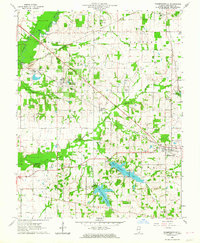
Other maps of this area

1908 · Galatia
USGS Topo · 1:62,500

1909 · West Frankfort
USGS Topo · 1:62,500

1938 · Galatia
USGS Topo · 1:62,500

1939 · Ina
USGS Topo · 1:62,500

1941 · West Frankfort
USGS Topo · 1:62,500

1942 · McLeansboro
USGS Topo · 1:62,500

1943 · Ina
USGS Topo · 1:62,500

1945 · McLeansboro
USGS Topo · 1:62,500

1949 · Paducah
USGS Topo · 1:250,000

1950 · Paducah
USGS Topo · 1:250,000