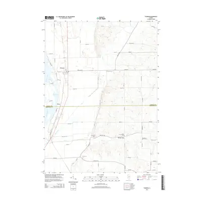
2015 Map of Thomson
USGS Topo · Published 2015About this map
The Mississippi River and its backwaters, such as Potter Slough, define the western edge of this agricultural landscape along the border of Carroll and Whiteside counties. The village of Thomson serves as a primary hub, while the smaller settlement of Ebner sits further south along the river's edge. This 2015 survey reveals a terrain heavily influenced by the drainage patterns of Johnson Creek and Otter Cr, which meander through the fertile lowlands. Local history is deeply rooted in the rural community, evidenced by numerous burial grounds including the Lower York Cem, Hollinshead Cem, and Baker Cem. The eastern portion of the area, near Spring Valley, shows a concentrated religious and civic legacy with the neighboring Spring Valley Methodist Cem and Spring Valley Presbyterian Cem, illustrating the denominational foundations of these early prairie settlements.
Find a feature on this map
53 named features on this map. Tap any name to fly to it.
Don’t see what you’re looking for? This feature index may not catch every label — zoom into the map to look around manually.
Map Details
Editions of this 2015 Thomson Map
This is the sole edition of this map. No revisions or reprints were ever made.
Other maps of this area

1891 · Clinton
USGS Topo · 1:62,500

1892 · Savanna
USGS Topo · 1:62,500

1894 · Clinton
USGS Topo · 1:62,500

1899 · Clinton
USGS Topo · 1:125,000

1934 · Morrison
USGS Topo · 1:48,000

1940 · Morrison
USGS Topo · 1:62,500

1942 · Mt Carroll
USGS Topo · 1:62,500

1944 · Mt Carroll
USGS Topo · 1:62,500

1952 · Clinton
USGS Topo · 1:62,500

1952 · Savanna
USGS Topo · 1:62,500