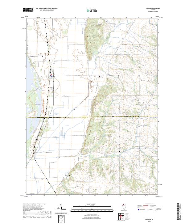
2024 Map of Thomson
USGS Topo · Published 2024About this map
The Upper Mississippi River National Wildlife and Fish Refuge dominates the western edge of this landscape, where the floodplain transition is marked by complex waterways like Potter Slough and Old Goose Lake. The settlement of Thomson sits just above the marshlands, serving as a hub for the surrounding agricultural uplands. Moving east, the terrain rises into the bluffs along Scenic Bluff Rd, where the drainage patterns of Johnson Creek and Otter Creek have carved a network of ridges and hollows.
Find a feature on this map
55 named features on this map. Tap any name to fly to it.
Don’t see what you’re looking for? This feature index may not catch every label — zoom into the map to look around manually.
Map Details
Editions of this 2024 Thomson Map
This is the sole edition of this map. No revisions or reprints were ever made.
Other maps of this area

1891 · Clinton
USGS Topo · 1:62,500

1892 · Savanna
USGS Topo · 1:62,500

1894 · Clinton
USGS Topo · 1:62,500

1899 · Clinton
USGS Topo · 1:125,000

1934 · Morrison
USGS Topo · 1:48,000

1940 · Morrison
USGS Topo · 1:62,500

1942 · Mt Carroll
USGS Topo · 1:62,500

1944 · Mt Carroll
USGS Topo · 1:62,500

1952 · Clinton
USGS Topo · 1:62,500

1952 · Savanna
USGS Topo · 1:62,500