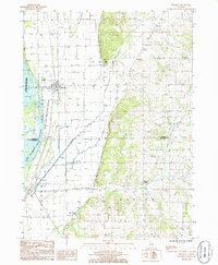
1985 Map of Thomson
USGS Topo · Published 1986About this map
The Upper Mississippi River dominates the western edge of this landscape, defining a complex ecosystem within the Upper Mississippi River Wild Life and Fish Refuge. East of the river, the landscape transitions from the aquatic margins of Potters Marsh and Potters Slough into the agricultural plains where Thomson serves as the primary settlement. The town is marked by its proximity to the Burlington Northern railroad, a vital corridor for mid-20th-century commerce in Carroll Co.
Find a feature on this map
25 named features on this map. Tap any name to fly to it.
Don’t see what you’re looking for? This feature index may not catch every label — zoom into the map to look around manually.
Map Details
Editions of this 1985 Thomson Map
This is the sole edition of this map. No revisions or reprints were ever made.
Other maps of this area

1891 · Clinton
USGS Topo · 1:62,500

1892 · Savanna
USGS Topo · 1:62,500

1894 · Clinton
USGS Topo · 1:62,500

1899 · Clinton
USGS Topo · 1:125,000

1934 · Morrison
USGS Topo · 1:48,000

1940 · Morrison
USGS Topo · 1:62,500

1942 · Mt Carroll
USGS Topo · 1:62,500

1944 · Mt Carroll
USGS Topo · 1:62,500

1952 · Clinton
USGS Topo · 1:62,500

1952 · Savanna
USGS Topo · 1:62,500