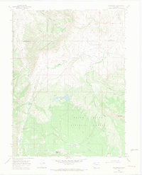
1966 Map of Thornburgh
USGS Topo · Published 1969About this map
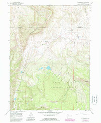
Thornburgh (Historical Site) marks a significant point of interest near Milk Creek in this mid-1960s survey of the Moffat and Rio Blanco county line. The landscape is defined by resource extraction and high-altitude water management, featuring the Thornburgh Gas Field and numerous prospects near Uranium Peak. The southern portion of the map transitions into the White River National Forest, where a network of primitive infrastructure including a Jeep Trail, Pack Trail, and Stock Driveway suggests a territory utilized for both recreation and livestock movement.
Find a feature on this map
28 named features on this map. Tap any name to fly to it.
Don’t see what you’re looking for? This feature index may not catch every label — zoom into the map to look around manually.
Map Details
Editions of this 1966 Thornburgh Map
6 editions found
Other maps of this area

1910 · Danforth Hills
USGS Topo · 1:125,000

1912 · Meeker
USGS Topo · 1:62,500

1912 · Axial
USGS Topo · 1:62,500

1914 · Meeker
USGS Topo · 1:62,500

1914 · Axial
USGS Topo · 1:62,500

1915 · Monument Butte
USGS Topo · 1:62,500

1954 · Craig
USGS Topo · 1:250,000

1957 · Craig
USGS Topo · 1:250,000

1958 · Craig
USGS Topo · 1:250,000

1960 · Craig
USGS Topo · 1:250,000