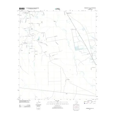
2013 Map of Thorson Gully
USGS Topo · Published 2013About this map
Batson and the historic Batson Oil Field define the northern landscape of this Hardin County survey. The area transitions from the oil-rich heights around Batson Prairie down into the dense drainage networks of the Big Thicket region. Waterways like Pine Island Bayou, Minner Slough, and Mayhaw Cr dominate the southern and eastern reaches, creating a complex environment of sloughs and bends such as Rattlesnake Bend and Taso Cove.
Find a feature on this map
63 named features on this map. Tap any name to fly to it.
Don’t see what you’re looking for? This feature index may not catch every label — zoom into the map to look around manually.
Map Details
Editions of this 2013 Thorson Gully Map
This is the sole edition of this map. No revisions or reprints were ever made.
Other maps of this area

1943 · Liberty
USGS Topo · 1:125,000

1954 · Beaumont
USGS Topo · 1:250,000

1955 · Daisetta
USGS Topo · 1:62,500

1955 · Saratoga
USGS Topo · 1:62,500

1955 · Kountze
USGS Topo · 1:62,500

1955 · Sour Lake
USGS Topo · 1:62,500

1957 · Beaumont
USGS Topo · 1:250,000

1984 · Beaumont
USGS Topo · 1:250,000
1984 · Nome
USGS Topo · 1:24,000

1984 · Sour Lake
USGS Topo · 1:24,000