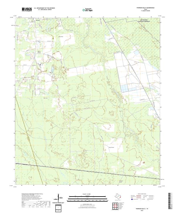
2022 Map of Thorson Gully
USGS Topo · Published 2022About this map
Batson sits at the northwestern edge of a landscape defined by the dense vegetation and winding waterways of Southeast Texas. This recent survey illustrates the area's transition from the developed roads around the settlement to the protected wilderness of the Big Thicket National Preserve. The map reveals a series of distinct prairie openings amidst the timber, including Batson Prairie, Sams Prairie, and Stockpen Prairie, which likely served as early navigational landmarks for ranchers and settlers. Genealogy researchers will find several family-named landmarks and historical burial sites, such as Guedry Cem and Jordan Cem, documenting generations of local residents. The hydrography of the region is complex, dominated by the sluggish flow of Pine Island Bayou and the network of drainages like Thorson Gully and Mayhaw Cr that feed into the coastal basin.
Find a feature on this map
53 named features on this map. Tap any name to fly to it.
Don’t see what you’re looking for? This feature index may not catch every label — zoom into the map to look around manually.
Map Details
Editions of this 2022 Thorson Gully Map
This is the sole edition of this map. No revisions or reprints were ever made.
Other maps of this area

1943 · Liberty
USGS Topo · 1:125,000

1954 · Beaumont
USGS Topo · 1:250,000

1955 · Daisetta
USGS Topo · 1:62,500

1955 · Saratoga
USGS Topo · 1:62,500

1955 · Kountze
USGS Topo · 1:62,500

1955 · Sour Lake
USGS Topo · 1:62,500

1957 · Beaumont
USGS Topo · 1:250,000

1984 · Beaumont
USGS Topo · 1:250,000
1984 · Nome
USGS Topo · 1:24,000

1984 · Sour Lake
USGS Topo · 1:24,000