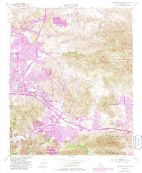
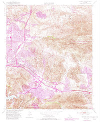
1950 Map of Thousand Oaks
USGS Topo · Published 1985About this map
Thousand Oaks sits at the heart of this mid-century landscape, positioned along the corridor where the Ventura Freeway and Moorpark Road meet. The area is defined by the transition from ranching lands like the Lang Ranch to expanding residential developments. The terrain is dominated by the dramatic uplift of the Santa Monica Mountains and the Simi Hills, with Simi Peak overlooking the El Conejo and Russell Valley.
Find a feature on this map
46 named features on this map. Tap any name to fly to it.
Don’t see what you’re looking for? This feature index may not catch every label — zoom into the map to look around manually.
Map Details
Editions of this 1950 Thousand Oaks Map
5 editions found
Other maps of this area

1900 · Triunfo Pass
USGS Topo · 1:62,500

1900 · Piru
USGS Topo · 1:62,500

1903 · Calabasas
USGS Topo · 1:62,500

1903 · Camulos
USGS Topo · 1:125,000

1903 · Santa Susana
USGS Topo · 1:62,500

1921 · Piru
USGS Topo · 1:62,500

1921 · Triunfo Pass
USGS Topo · 1:62,500

1929 · Vejor
USGS Topo · 1:24,000

1932 · Seminole
USGS Topo · 1:24,000

1932 · Russell Valley
USGS Topo · 1:24,000