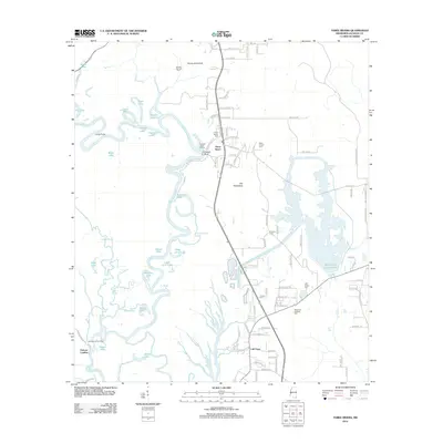
2012 Map of Three Rivers
USGS Topo · Published 2012About this map
The Pascagoula River system dominates this part of Jackson County, weaving a complex network of waterways including Sawlog Slough, Vaughn Bayou, and the distinctive oxbow known as The Horseshoe. The landscape is defined by its riparian character, with settlements like Three Rivers and Cumbest Bluff situated near the riverbanks. Local history is deeply etched into the land through numerous family and community burial sites, such as Caswell Springs Cem and Davis Chapel Cem, which anchor the surrounding rural tracts.
Find a feature on this map
116 named features on this map. Tap any name to fly to it.
Don’t see what you’re looking for? This feature index may not catch every label — zoom into the map to look around manually.
Map Details
Editions of this 2012 Three Rivers Map
This is the sole edition of this map. No revisions or reprints were ever made.
Other maps of this area

1921 · Grand Bay
USGS Topo · 1:62,500

1941 · Hurley
USGS Topo · 1:62,500

1941 · Vancleave
USGS Topo · 1:62,500

1943 · Pascagoula
USGS Topo · 1:62,500

1943 · Grand Bay
USGS Topo · 1:62,500

1943 · Hurley
USGS Topo · 1:62,500

1943 · Vancleave
USGS Topo · 1:62,500

1944 · Vancleave
USGS Topo · 1:62,500

1953 · Mobile
USGS Topo · 1:250,000

1955 · Pascagoula
USGS Topo · 1:62,500