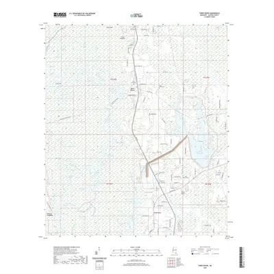
2020 Map of Three Rivers
USGS Topo · Published 2020About this map
The Pascagoula River system dominates this landscape of the Mississippi Gulf Coast region, creating a labyrinth of waterways such as West Pascagoula River, Squeeze Belly Bayou, and Gray Bayou. This modern survey illustrates how local communities like Three Rivers and Coll Town are intertwined with the river's shifting channels and backwater lakes, including Parish Lake and Gater Lake. The density of family-named cemeteries, such as Caswell Springs Cem and Hudson Cem, suggests a deep-rooted genealogical history within these lowlands.
Find a feature on this map
103 named features on this map. Tap any name to fly to it.
Don’t see what you’re looking for? This feature index may not catch every label — zoom into the map to look around manually.
Map Details
Editions of this 2020 Three Rivers Map
This is the sole edition of this map. No revisions or reprints were ever made.
Other maps of this area

1921 · Grand Bay
USGS Topo · 1:62,500

1941 · Hurley
USGS Topo · 1:62,500

1941 · Vancleave
USGS Topo · 1:62,500

1943 · Pascagoula
USGS Topo · 1:62,500

1943 · Grand Bay
USGS Topo · 1:62,500

1943 · Hurley
USGS Topo · 1:62,500

1943 · Vancleave
USGS Topo · 1:62,500

1944 · Vancleave
USGS Topo · 1:62,500

1953 · Mobile
USGS Topo · 1:250,000

1955 · Pascagoula
USGS Topo · 1:62,500