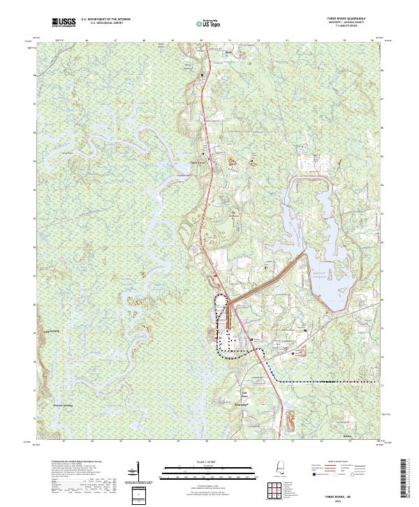
2024 Map of Three Rivers
USGS Topo · Published 2024About this map
Pascagoula River and its intricate network of bayous and lakes dominate this Jackson County landscape, creating a complex wetland environment where land and water blur. The settlement of Three Rivers sits at a geographic crossroads, surrounded by numerous family-named landmarks such as Cumbest Bluff, Ashley Hammock, and roads like George Cumbest Rd. This modern survey reveals a deep-rooted community structure anchored by small family and church cemeteries, including Caswell Springs Cem and Davis Chapel Cem. To the south, the reach of Escatawpa and Vancleave show the gradual expansion of residential areas toward the river's edge. The presence of the Black Creek cooling pond and the Farm Service Agency Interest of Mississippi tract indicates modern industrial and governmental land use alongside traditional river landings like Poticaw Landing.
Find a feature on this map
109 named features on this map. Tap any name to fly to it.
Don’t see what you’re looking for? This feature index may not catch every label — zoom into the map to look around manually.
Map Details
Editions of this 2024 Three Rivers Map
This is the sole edition of this map. No revisions or reprints were ever made.
Other maps of this area

1921 · Grand Bay
USGS Topo · 1:62,500

1941 · Hurley
USGS Topo · 1:62,500

1941 · Vancleave
USGS Topo · 1:62,500

1943 · Pascagoula
USGS Topo · 1:62,500

1943 · Grand Bay
USGS Topo · 1:62,500

1943 · Hurley
USGS Topo · 1:62,500

1943 · Vancleave
USGS Topo · 1:62,500

1944 · Vancleave
USGS Topo · 1:62,500

1953 · Mobile
USGS Topo · 1:250,000

1955 · Pascagoula
USGS Topo · 1:62,500