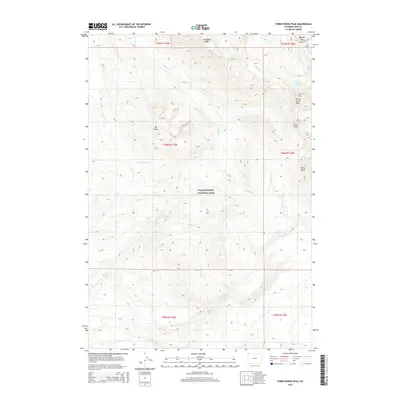
2015 Map of Three Rivers Peak
USGS Topo · Published 2015About this map
Three Rivers Peak serves as a massive hydrological hub within Yellowstone National Park, anchoring a landscape defined by high-elevation drainage systems. From the north, the Gallatin River emerges near Gallatin Lake, while numerous tributaries like Grayling Creek, Maple Creek, and Gneiss Creek carve through the surrounding high country. This 2015 survey illustrates the primitive infrastructure of the backcountry, focusing on the Bighorn Pass Trail as it crosses Bighorn Pass near the northern boundary of the park. The terrain is dominated by prominent ridges and summits, including Crowfoot Ridge, Echo Peak, and the distinct formation of The Crags. This map provides a detailed view of the headwaters that feed into the larger Missouri River system, tracing the exact paths of these wilderness waterways before they leave the protected confines of the park.
Find a feature on this map
20 named features on this map. Tap any name to fly to it.
Don’t see what you’re looking for? This feature index may not catch every label — zoom into the map to look around manually.
Map Details
Editions of this 2015 Three Rivers Peak Map
This is the sole edition of this map. No revisions or reprints were ever made.
Other maps of this area

1885 · Gallatin
USGS Topo · 1:125,000

1885 · Gallatin
USGS Topo · 1:125,000

1901 · Gallatin
USGS Topo · 1:125,000

1908 · Gallatin
USGS Topo · 1:125,000

1911 · Gallatin
USGS Topo · 1:125,000

1955 · Ashton
USGS Topo · 1:250,000

1958 · Ashton
USGS Topo · 1:250,000

1958 · Madison Junction
USGS Topo · 1:62,500

1958 · Mount Holmes
USGS Topo · 1:62,500

1958 · West Yellowstone
USGS Topo · 1:62,500