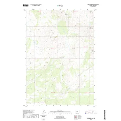
2017 Map of Three Rivers Peak
USGS Topo · Published 2017About this map
Yellowstone National Park encompasses the high-altitude wilderness of this northwestern section of Park County, where complex drainage systems define the high country. The landmark Three Rivers Peak serves as a significant hydrologic hub, presiding over a landscape where the Gallatin River and Grayling Creek begin their descent. This 2017 survey details the dramatic elevations of Crowfoot Ridge and The Crags, alongside the alpine waters of Gallatin Lake. To the south and west, the map traces the winding paths of Gneiss Creek, Maple Creek, and Campanula Creek as they cut through the timbered slopes. Notable geographic features such as Bighorn Pass, Echo Peak, and the White Peaks provide critical orientation points for this remote backcountry region, illustrating the diverse topography that characterizes the park's interior mountain ranges.
Find a feature on this map
19 named features on this map. Tap any name to fly to it.
Don’t see what you’re looking for? This feature index may not catch every label — zoom into the map to look around manually.
Map Details
Editions of this 2017 Three Rivers Peak Map
This is the sole edition of this map. No revisions or reprints were ever made.
Other maps of this area

1885 · Gallatin
USGS Topo · 1:125,000

1885 · Gallatin
USGS Topo · 1:125,000

1901 · Gallatin
USGS Topo · 1:125,000

1908 · Gallatin
USGS Topo · 1:125,000

1911 · Gallatin
USGS Topo · 1:125,000

1955 · Ashton
USGS Topo · 1:250,000

1958 · Ashton
USGS Topo · 1:250,000

1958 · Madison Junction
USGS Topo · 1:62,500

1958 · Mount Holmes
USGS Topo · 1:62,500

1958 · West Yellowstone
USGS Topo · 1:62,500