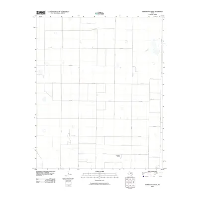
2010 Map of Three Way School
USGS Topo · Published 2010About this map
Three Way School stands as the central landmark in this West Texas agricultural landscape, anchoring a vast grid of section roads and rural properties. The terrain is defined by its characteristic High Plains topography, where seasonal depressions and playas are scattered across the level surface between well-maintained county routes. This 2010 survey by the U.S. Geological Survey details a sophisticated irrigation and transport network, with major corridors like Fm 1731 and Co Rd 1234 connecting the scattered farmsteads. The precision of the road layout, including Co Rd 1254 and Co Rd 1284, reflects the systematic land partitioning essential to the region's ranching and cotton-farming heritage.
Find a feature on this map
20 named features on this map. Tap any name to fly to it.
Don’t see what you’re looking for? This feature index may not catch every label — zoom into the map to look around manually.
Map Details
Editions of this 2010 Three Way School Map
This is the sole edition of this map. No revisions or reprints were ever made.
Other maps of this area

1954 · Clovis
USGS Topo · 1:250,000

1954 · Brownfield
USGS Topo · 1:250,000

1957 · Arch
USGS Topo · 1:62,500

1958 · Brownfield
USGS Topo · 1:250,000

1958 · Clovis
USGS Topo · 1:250,000

1962 · Brownfield
USGS Topo · 1:250,000

1962 · Stegall
USGS Topo · 1:24,000

1962 · Baileyboro
USGS Topo · 1:24,000

1968 · Three Way School
USGS Topo · 1:24,000
1968 · Upper White Lake
USGS Topo · 1:24,000