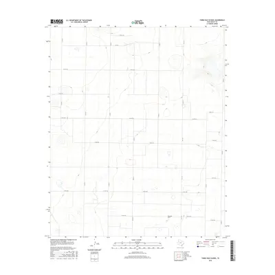
2016 Map of Three Way School
USGS Topo · Published 2016About this map
Three Way School serves as a central landmark in this portion of Bailey County, marking a localized hub in an otherwise vast expanse of high plains. The landscape is characterized by a distinctive grid of county roads, including north-south corridors like Co Rd 61 and Co Rd 71, and east-west routes such as Co Rd 1254. These roads outline the large-scale agricultural blocks typical of the Texas Panhandle. The terrain is dotted with numerous small, ephemeral depressions or playa lakes, a common hydrological feature of the Llano Estacado. Movement through the area is facilitated by Fm 1731, which connects the school site to the broader regional network. The concentration of road labels like Co Rd 1294 near the school suggests a localized center of activity within the rural landscape.
Find a feature on this map
21 named features on this map. Tap any name to fly to it.
Don’t see what you’re looking for? This feature index may not catch every label — zoom into the map to look around manually.
Map Details
Editions of this 2016 Three Way School Map
This is the sole edition of this map. No revisions or reprints were ever made.
Other maps of this area

1954 · Clovis
USGS Topo · 1:250,000

1954 · Brownfield
USGS Topo · 1:250,000

1957 · Arch
USGS Topo · 1:62,500

1958 · Brownfield
USGS Topo · 1:250,000

1958 · Clovis
USGS Topo · 1:250,000

1962 · Brownfield
USGS Topo · 1:250,000

1962 · Stegall
USGS Topo · 1:24,000

1962 · Baileyboro
USGS Topo · 1:24,000

1968 · Three Way School
USGS Topo · 1:24,000
1968 · Upper White Lake
USGS Topo · 1:24,000