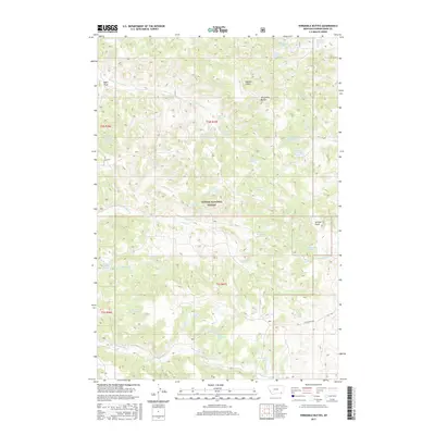
2017 Map of Threemile Buttes
USGS Topo · Published 2017About this map
Custer National Forest encompasses much of this landscape, where the high-plains terrain is carved by an extensive network of ephemeral drainages and named springs. The central elevation is anchored by the Threemile Buttes, while the surrounding coulees and draws such as Doonan Gulch and Skinner Gulch suggest a long history of cattle ranching and water resource management. This reliance on groundwater is evident in the numerous named points like Old Faithful Spring, Sawmill Spring, and Mankameyer Spring. The presence of the Bowers Reservoir and the naming of Fifteen Mile Rd illustrate the human imprint on this corner of Powder River County, Montana. Collectors and researchers can trace the movement of water and transport through this remote cattle country, from the headwaters of S Fork Threemile Cr to the southern reaches of Fifteenmile Cr.
Find a feature on this map
50 named features on this map. Tap any name to fly to it.
Don’t see what you’re looking for? This feature index may not catch every label — zoom into the map to look around manually.
Map Details
Editions of this 2017 Threemile Buttes Map
This is the sole edition of this map. No revisions or reprints were ever made.
Other maps of this area

1954 · Hardin
USGS Topo · 1:250,000

1954 · Ekalaka
USGS Topo · 1:250,000

1956 · Ekalaka
USGS Topo · 1:250,000

1957 · Hardin
USGS Topo · 1:250,000

1958 · Ekalaka
USGS Topo · 1:250,000

1958 · Hardin
USGS Topo · 1:250,000

1965 · Ekalaka
USGS Topo · 1:250,000

1966 · Goodspeed Butte
USGS Topo · 1:24,000

1966 · Sonnette
USGS Topo · 1:24,000

1966 · Coleman Draw
USGS Topo · 1:24,000