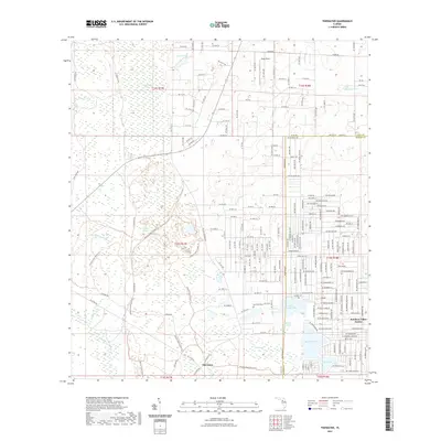
2021 Map of Tidewater
USGS Topo · Published 2021About this map
Goethe State Forest dominates the western half of this Florida landscape, where a dense network of forest trails and drainage ways like Crow Rookery Slough and Coffee Creek define the low-lying terrain. The transition from the protected forest to the developed residential grids of Rainbow Lakes Estates in the east provides a clear look at local land-use patterns. Near the small settlement of Tidewater, the topography is characterized by wet prairies and cypress stands, including the aptly named Cypress Prairie and the waters of Bonable Lake. Local history is anchored by the Sand Pond Cem and several family-named water bodies such as Race Pond and Big Wolf Arbor. The map also captures the Wings Field airstrip and the dividing line between Levy and Marion Counties, tracing the hydrological connections of the Tenmile Cr system.
Find a feature on this map
32 named features on this map. Tap any name to fly to it.
Don’t see what you’re looking for? This feature index may not catch every label — zoom into the map to look around manually.
Map Details
Editions of this 2021 Tidewater Map
This is the sole edition of this map. No revisions or reprints were ever made.
Other maps of this area

1892 · Dunnellon
USGS Topo · 1:62,500

1894 · Dunnellon
USGS Topo · 1:62,500

1895 · Williston
USGS Topo · 1:62,500

1954 · Romeo
USGS Topo · 1:24,000

1954 · Dunnellon
USGS Topo · 1:24,000

1954 · Yankeetown SE
USGS Topo · 1:24,000

1954 · Bronson SW
USGS Topo · 1:24,000

1954 · Dunnellon
USGS Topo · 1:62,500

1954 · Gainesville
USGS Topo · 1:250,000

1955 · Lebanon Station
USGS Topo · 1:24,000