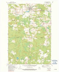
1970 Map of Tigerton
USGS Topo · Published 1990About this map
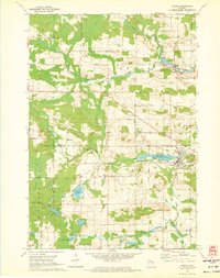
Tigerton serves as the primary hub in this pocket of the Wisconsin northwoods, situated along the South Branch Embarrass River. The landscape reveals a transition from the village center, marked by Tigerton Pond and a local Trailer Park, into the surrounding rural townships of Germania, Fairbanks, and Wyoming. Industrial activity is evident through the numerous Gravel Pit sites scattered across the terrain and the tracks of the Chicago and North Western railroad that cut through the countryside.
Find a feature on this map
38 named features on this map. Tap any name to fly to it.
Don’t see what you’re looking for? This feature index may not catch every label — zoom into the map to look around manually.
Map Details
Editions of this 1970 Tigerton Map
2 editions found
Other maps of this area

1954 · Wittenberg
USGS Topo · 1:48,000

1954 · Gresham
USGS Topo · 1:48,000

1955 · Clintonville
USGS Topo · 1:48,000

1955 · Tigerton
USGS Topo · 1:48,000

1955 · Green Bay
USGS Topo · 1:250,000

1964 · Wittenberg
USGS Topo · 1:62,500

1964 · Gresham
USGS Topo · 1:62,500
1970 · Tigerton NW
USGS Topo · 1:24,000
1970 · Symco
USGS Topo · 1:24,000
1970 · Marion
USGS Topo · 1:24,000