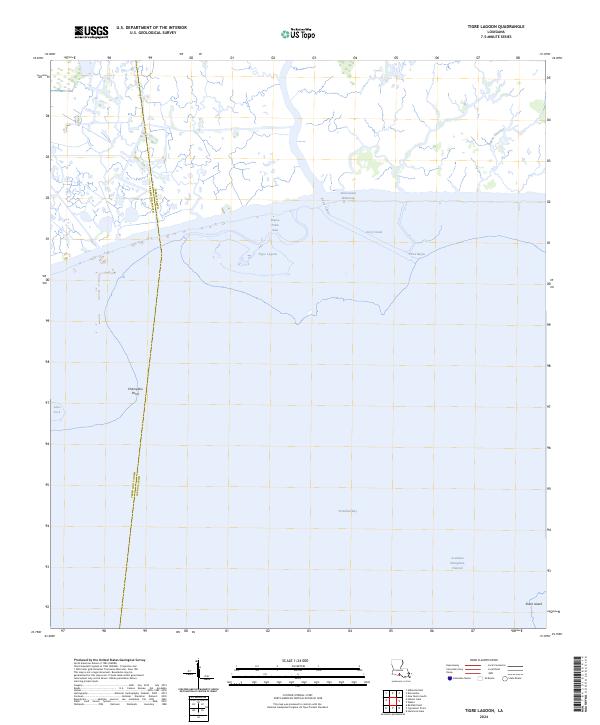
2024 Map of Tigre Lagoon
USGS Topo · Published 2024About this map
The boundary between Iberia Parish and Vermilion Parish defines this coastal landscape where the Louisiana marsh meets the expansive Vermilion Bay. The area is characterized by a complex network of natural bayous and engineered waterways, including the Intracoastal Waterway and the Acadiana Navigation Channel, which facilitate transit through the low-lying terrain. The map highlights the interplay of land and water at sites like Champlain Point and Shark Island, while inland features such as Tigre Lagoon and Bayou Petite Anse illustrate the intricate drainage patterns of the gulf coast. These waterways, alongside the Avery Canal, reflect a region shaped by both commercial navigation and the natural rhythms of the marshland. The lack of dense road infrastructure underscores the dominance of the wetland environment in this part of southern Louisiana.
Find a feature on this map
17 named features on this map. Tap any name to fly to it.
Don’t see what you’re looking for? This feature index may not catch every label — zoom into the map to look around manually.
Map Details
Editions of this 2024 Tigre Lagoon Map
This is the sole edition of this map. No revisions or reprints were ever made.
Other maps of this area

1932 · Abbeville SE
USGS Topo · 1:31,680

1932 · Abbeville NE
USGS Topo · 1:31,680

1937 · Derouen
USGS Topo · 1:62,500

1945 · New Orleans
USGS Topo · 1:250,000

1946 · Redfish Point NE
USGS Topo · 1:31,680

1948 · Cypremort Point
USGS Topo · 1:24,000

1949 · Cypremort Pt
USGS Topo · 1:31,680

1951 · Cheniere Au Tigre
USGS Topo · 1:62,500
1954 · Redfish Point NE
USGS Topo · 1:31,680

1954 · Port Arthur
USGS Topo · 1:250,000