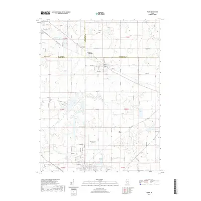
2018 Map of Tilden
USGS Topo · Published 2018About this map
Sparta and Marissa anchor this 2018 survey of southwestern Illinois, where the confluence of St. Clair, Washington, and Randolph counties defines a landscape of agricultural tradition and industrial legacy. The infrastructure of the area is heavily influenced by the BNSF Railway, which cuts through Tilden and Clarmin, linking these small coal-country settlements to the larger region. The transition from industrial activity to local recreation is evident at the Marissa Recreation Association South Lake and the New City Reservoir, while the expansive Flat Prairie remains a dominant geographic feature east of the Marys River. Local history is preserved at sites like Hill Prairie Cem and Caledonia Cem, providing essential markers for genealogical research. The presence of both the Herschel Hunter Airport and Sparta Community Airport-Hunter Field underscores the region's role as a local aviation hub amid the surrounding farmland.
Find a feature on this map
106 named features on this map. Tap any name to fly to it.
Don’t see what you’re looking for? This feature index may not catch every label — zoom into the map to look around manually.
Map Details
Editions of this 2018 Tilden Map
This is the sole edition of this map. No revisions or reprints were ever made.
Other maps of this area

1910 · Okawville
USGS Topo · 1:62,500

1912 · New Athens
USGS Topo · 1:62,500

1912 · Baldwin
USGS Topo · 1:62,500

1914 · Baldwin
USGS Topo · 1:62,500

1914 · Coulterville
USGS Topo · 1:62,500

1917 · Coulterville
USGS Topo · 1:62,500

1940 · Okawville
USGS Topo · 1:62,500

1942 · Baldwin
USGS Topo · 1:62,500
1954 · New Athens East
USGS Topo · 1:24,000
1954 · New Athens
USGS Topo · 1:62,500