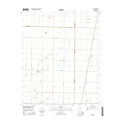
2014 Map of Tilton
USGS Topo · Published 2014About this map
Bayou De View snakes through a landscape defined by organized agricultural tracts and scattered rural settlements across the intersection of Jackson, Woodruff, and Cross counties. The settlement of Tilton serves as a primary hub in the east, while the community of Pumpkin Bend and the surrounding Pumpkin Bend Cem anchor the western reaches. This area is characterized by a high density of secondary roads such as Ar-145 and Woodruff 350 Rd that facilitate access to the flat, fertile plains. Further south, the map reveals the town of Morton and the high ground of Pea Ridge, which stands in contrast to the low-lying waters of King Lake. Local landmarks like Sailor Harris Ridge provide distinctive geographical markers within this part of the Arkansas delta, illustrating the region's long-standing connection to timber and farming.
Find a feature on this map
64 named features on this map. Tap any name to fly to it.
Don’t see what you’re looking for? This feature index may not catch every label — zoom into the map to look around manually.
Map Details
Editions of this 2014 Tilton Map
This is the sole edition of this map. No revisions or reprints were ever made.
Other maps of this area

1939 · Vanndale
USGS Topo · 1:62,500

1939 · Wynne
USGS Topo · 1:62,500

1939 · Hunter
USGS Topo · 1:62,500

1940 · Tilton
USGS Topo · 1:62,500

1953 · Memphis
USGS Topo · 1:250,000

1956 · Memphis
USGS Topo · 1:250,000

1956 · Tilton
USGS Topo · 1:62,500

1956 · Hunter
USGS Topo · 1:62,500

1958 · Hunter
USGS Topo · 1:62,500

1958 · Wynne
USGS Topo · 1:62,500