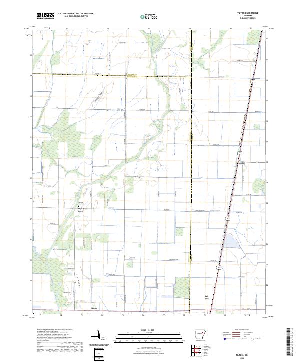
2024 Map of Tilton
USGS Topo · Published 2024About this map
Bayou De View snakes through the heart of this landscape, anchoring the eastern edge of the Cache River National Wildlife Refuge. The map reveals a highly structured agricultural grid, where drainage patterns and property lines dictate the placement of small communities like Tilton and Pumpkin Bend. Local history and genealogy researchers will find the specific locations of the Pumpkin Bend Cem and Morton Cem particularly valuable for tracing family roots in this corner of Arkansas. Elevated terrain features such as Sailor Harris Ridge and Pea Ridge break the low-lying river bottom topography. The settlement of Morton and the rail-aligned community of Fair Oaks further illustrate the area's development around transportation corridors and fertile river lands.
Find a feature on this map
62 named features on this map. Tap any name to fly to it.
Don’t see what you’re looking for? This feature index may not catch every label — zoom into the map to look around manually.
Map Details
Editions of this 2024 Tilton Map
This is the sole edition of this map. No revisions or reprints were ever made.
Other maps of this area

1939 · Vanndale
USGS Topo · 1:62,500

1939 · Wynne
USGS Topo · 1:62,500

1939 · Hunter
USGS Topo · 1:62,500

1940 · Tilton
USGS Topo · 1:62,500

1953 · Memphis
USGS Topo · 1:250,000

1956 · Memphis
USGS Topo · 1:250,000

1956 · Tilton
USGS Topo · 1:62,500

1956 · Hunter
USGS Topo · 1:62,500

1958 · Hunter
USGS Topo · 1:62,500

1958 · Wynne
USGS Topo · 1:62,500