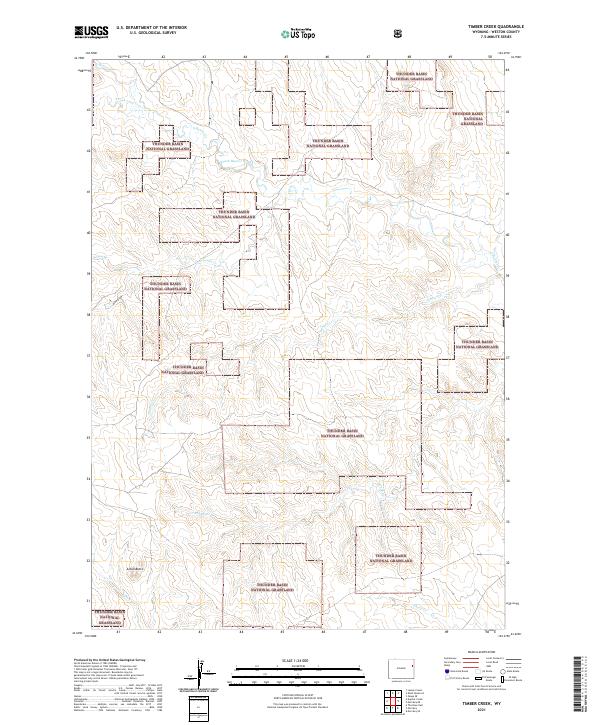
2021 Map of Timber Creek
USGS Topo · Published 2021About this map
Thunder Basin National Grassland dominates this section of Weston County, where a complex network of seasonal drainages carves through the high plains. The landscape is defined by the branching tributaries of South Beaver Creek and the winding course of Timber Creek, which flow through various sections of the federally managed grasslands. A notable landmark in the southwestern portion of the sheet is Alkali Butte, rising above the surrounding terrain near the headwaters of Alkali Creek. The map documents a sparsely settled region of Wyoming, primarily characterized by the public-private land grid and the natural topography of draws like Finn Draw and named watercourses including Rough Creek and Louse Creek. This area reflects the modern management of open range and watershed protection in the Great Plains.
Find a feature on this map
17 named features on this map. Tap any name to fly to it.
Don’t see what you’re looking for? This feature index may not catch every label — zoom into the map to look around manually.
Map Details
Editions of this 2021 Timber Creek Map
This is the sole edition of this map. No revisions or reprints were ever made.
Other maps of this area

1899 · Newcastle
USGS Topo · 1:125,000

1901 · Newcastle
USGS Topo · 1:125,000

1951 · Morrisey NE
USGS Topo · 1:24,000

1951 · Osage SE
USGS Topo · 1:24,000

1955 · Newcastle
USGS Topo · 1:250,000

1958 · Newcastle
USGS Topo · 1:250,000
1972 · Klodt Reservoir
USGS Topo · 1:24,000

1979 · Newcastle
USGS Topo · 1:100,000
1982 · Morrisey
USGS Topo · 1:24,000
1982 · Morrisey SE
USGS Topo · 1:24,000