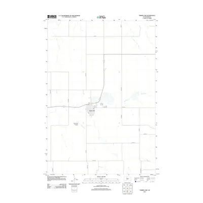
2012 Map of Timber Lake
USGS Topo · Published 2012About this map
Timber Lake serves as a central hub on the South Dakota plains, organized around a traditional grid of streets including 8th St, 9th St, and 10th St. This 2012 survey illustrates a landscape defined by its agricultural layout and vital transportation corridors, such as Co Hwy-6 and Whitehorse Rd, which connect the town to the surrounding rural reaches. The local infrastructure is anchored by the Timber Lake Municipal Airport to the west and the Holy Cross Cem on the eastern edge of the settlement. To the east, the intermittent course of Dog Butte Cr winds through the terrain, highlighting the natural drainage patterns that have influenced the placement of roads and homesteads in this part of Dewey County.
Find a feature on this map
26 named features on this map. Tap any name to fly to it.
Don’t see what you’re looking for? This feature index may not catch every label — zoom into the map to look around manually.
Map Details
Editions of this 2012 Timber Lake Map
This is the sole edition of this map. No revisions or reprints were ever made.
Other maps of this area

1952 · Whitehorse
USGS Topo · 1:24,000

1953 · McIntosh
USGS Topo · 1:250,000

1956 · Miscol SW
USGS Topo · 1:24,000

1956 · Little Eagle SW
USGS Topo · 1:24,000

1956 · Miscol SE
USGS Topo · 1:24,000

1958 · McIntosh
USGS Topo · 1:250,000

1975 · Glencross
USGS Topo · 1:24,000

1978 · Brewer Butte
USGS Topo · 1:24,000

1978 · Timber Lake
USGS Topo · 1:24,000

1978 · Little Moreau Lake
USGS Topo · 1:24,000