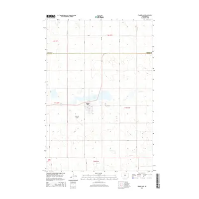
2015 Map of Timber Lake
USGS Topo · Published 2015About this map
The town of Timber Lake serves as the central hub of this prairie landscape, situated just south of its namesake body of water. The town grid is clearly defined, bordered to the west by the Timber Lake Municipal Airport. This 2015 survey illustrates the rural character of the region, where the Corson Co and Dewey Co border is traced by Co Line Rd, dividing the north and south sections of the quadrangle. Outside the immediate settlement, the terrain is defined by drainage patterns such as Dog Butte Cr and a network of secondary routes including CR-6 and CR-5. Cultural markers like Holy Cross Cem are situated on the outskirts of town, providing fixed points for local history and genealogical research in this sparsely populated part of the state.
Find a feature on this map
33 named features on this map. Tap any name to fly to it.
Don’t see what you’re looking for? This feature index may not catch every label — zoom into the map to look around manually.
Map Details
Editions of this 2015 Timber Lake Map
This is the sole edition of this map. No revisions or reprints were ever made.
Other maps of this area
1952 · Whitehorse
USGS Topo · 1:24,000
1953 · McIntosh
USGS Topo · 1:250,000
1956 · Miscol SW
USGS Topo · 1:24,000
1956 · Little Eagle SW
USGS Topo · 1:24,000
1956 · Miscol SE
USGS Topo · 1:24,000
1958 · McIntosh
USGS Topo · 1:250,000
1975 · Glencross
USGS Topo · 1:24,000
1978 · Brewer Butte
USGS Topo · 1:24,000
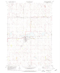
1978 · Timber Lake
USGS Topo · 1:24,000
1978 · Little Moreau Lake
USGS Topo · 1:24,000