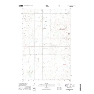
2017 Map of Timber Prong Creek
USGS Topo · Published 2017About this map
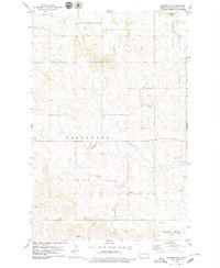
Little Missouri National Grassland dominates the eastern portion of this McKenzie County landscape, where the prairie is dissected by a network of drainage coulees and creeks. Two burial sites, Banks Lutheran Cem in the north and Garden Cem centrally located near 35 St NW, provide specific points of interest for genealogists tracing early settlement families in this part of North Dakota. The hydrology of the area is defined by the namesake Timber Prong Creek and the winding course of Tobacco Garden Cr, which illustrate the complex erosion patterns typical of the region's breaks. A grid of section roads including Co Rte 12 and 34th St NW provides access to the high-relief terrain where Porcupine Coulee and Clear Cr carve through the grassland bluffs.
Find a feature on this map
22 named features on this map. Tap any name to fly to it.
Don’t see what you’re looking for? This feature index may not catch every label — zoom into the map to look around manually.
Map Details
Editions of this 2017 Timber Prong Creek Map
This is the sole edition of this map. No revisions or reprints were ever made.
Other maps of this area
1911 · Ray
USGS Topo · 1:125,000

1953 · Williston
USGS Topo · 1:250,000
1953 · Watford City
USGS Topo · 1:250,000

1957 · Williston
USGS Topo · 1:250,000
1957 · Watford City
USGS Topo · 1:250,000
1967 · Watford City
USGS Topo · 1:250,000
1978 · Tobacco Garden Bay
USGS Topo · 1:24,000
1978 · Schafer
USGS Topo · 1:24,000
1978 · Watford City NE
USGS Topo · 1:24,000
1978 · Schafer SE
USGS Topo · 1:24,000