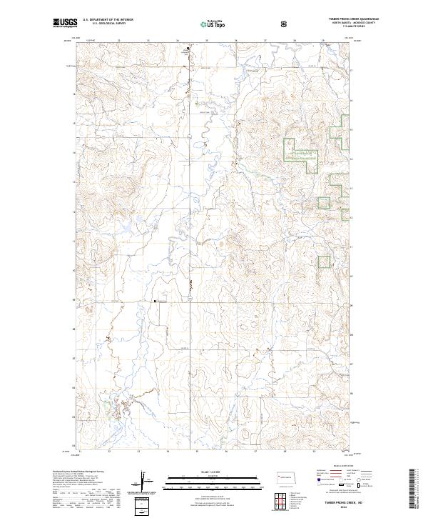
2024 Map of Timber Prong Creek
USGS Topo · Published 2024About this map
Banks Lutheran Cem and Garden Cem stand as markers of rural settlement in this portion of McKenzie County, where the plains are carved by the winding course of Tobacco Garden Creek. The landscape transition is evident where the public lands of the Little Missouri National Grassland meet the established section lines of the Public Land Survey System. High plateaus are dissected by drainage systems like Porcupine Coulee and Timber Prong Creek, revealing the intricate topography characteristic of the North Dakota badlands fringe. The road network, including Co Rte 12 and 40th St NW, follows the rigorous grid typical of the western prairie, connecting isolated agricultural homesteads and local landmarks in a region defined by its expansive grazing lands and intermittent watercourses.
Find a feature on this map
23 named features on this map. Tap any name to fly to it.
Don’t see what you’re looking for? This feature index may not catch every label — zoom into the map to look around manually.
Map Details
Editions of this 2024 Timber Prong Creek Map
This is the sole edition of this map. No revisions or reprints were ever made.
Other maps of this area

1911 · Ray
USGS Topo · 1:125,000

1953 · Williston
USGS Topo · 1:250,000

1953 · Watford City
USGS Topo · 1:250,000

1957 · Williston
USGS Topo · 1:250,000

1957 · Watford City
USGS Topo · 1:250,000

1967 · Watford City
USGS Topo · 1:250,000

1978 · Tobacco Garden Bay
USGS Topo · 1:24,000

1978 · Schafer
USGS Topo · 1:24,000

1978 · Watford City NE
USGS Topo · 1:24,000
1978 · Schafer SE
USGS Topo · 1:24,000