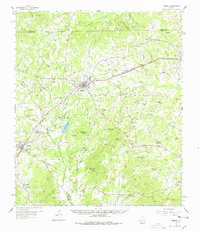
1958 Map of Timpson
USGS Topo · Published 1978About this map
The railroad towns of East Texas are the focus of this mid-century survey, centered on the junction of the Texas and New Orleans (SP) and the Gulf Colorado and Santa Fe at Timpson. This rail infrastructure drove the growth of nearby settlements like Tenaha and Garrison, while the rural landscape remained deeply connected to its local institutions. Numerous country churches and cemeteries, such as Todd Spring Ch, Mt Gideon Cem, and Weaver Cem, serve as landmarks for genealogists tracing family roots across Shelby, Rusk, and Nacogdoches Counties.
Find a feature on this map
71 named features on this map. Tap any name to fly to it.
Don’t see what you’re looking for? This feature index may not catch every label — zoom into the map to look around manually.
Map Details
Editions of this 1958 Timpson Map
2 editions found
Other maps of this area

1945 · Socagee Bayou
USGS Topo · 1:62,500

1952 · Nacogdoches
USGS Topo · 1:62,500

1953 · Palestine
USGS Topo · 1:250,000

1956 · Tyler
USGS Topo · 1:250,000

1956 · Deadwood
USGS Topo · 1:62,500

1957 · Palestine
USGS Topo · 1:250,000

1958 · Center
USGS Topo · 1:62,500

1958 · San Augustine
USGS Topo · 1:62,500

1958 · Martinsville
USGS Topo · 1:62,500

1958 · Timpson
USGS Topo · 1:62,500