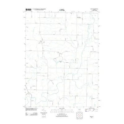
2012 Map of Tioga
USGS Topo · Published 2012About this map
Tioga and Breckenridge anchor this rural landscape in western Illinois, where a network of section roads connects isolated farmsteads and historic burial grounds. The area is defined by a dense drainage system including Bear Cr, Whiteoak Cr, and Lick Br, which carve through the agricultural fields of Adams County. Genealogists will find numerous small cemeteries preserved among the tracts, such as West Tioga Cem, Bethany Cem, and the remote Buckeye Cem in the north. The presence of Camp Saukenauk and the Hagemeister Landing Strip highlights modern recreational and private aviation uses of the land. This survey illustrates a resilient agrarian pattern where watercourses like Grindstone Cr and Little Cr dictate the placement of local routes like Co Rd-300 and E 1000th St.
Find a feature on this map
73 named features on this map. Tap any name to fly to it.
Don’t see what you’re looking for? This feature index may not catch every label — zoom into the map to look around manually.
Map Details
Editions of this 2012 Tioga Map
This is the sole edition of this map. No revisions or reprints were ever made.
Other maps of this area

1933 · Carthage
USGS Topo · 1:62,500

1936 · Keokuk
USGS Topo · 1:62,500

1937 · Carthage
USGS Topo · 1:62,500

1946 · Mendon
USGS Topo · 1:62,500

1948 · Mendon
USGS Topo · 1:62,500

1948 · Camp Point
USGS Topo · 1:62,500

1950 · Keokuk
USGS Topo · 1:62,500

1958 · Burlington
USGS Topo · 1:250,000

1961 · Burlington
USGS Topo · 1:250,000

1963 · Burlington
USGS Topo · 1:250,000