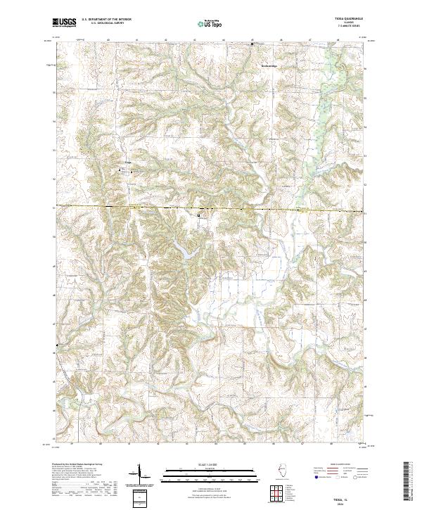
2024 Map of Tioga
USGS Topo · Published 2024About this map
Tioga and Breckenridge anchor this section of the Illinois prairie, where the landscape is defined by the complex drainage systems of Bear Creek and its many tributaries. The area's history is etched into its small rural burial grounds, including West Tioga Cem, Bethany Cem, and Karnes Cem, which remain as quiet landmarks of the region's early community life. The terrain is notably dissected by watercourses like Whiteoak Creek and Little Creek, creating a network of ridges and hollows that contrast with the more level agricultural land found further from the creek banks.
Find a feature on this map
72 named features on this map. Tap any name to fly to it.
Don’t see what you’re looking for? This feature index may not catch every label — zoom into the map to look around manually.
Map Details
Editions of this 2024 Tioga Map
This is the sole edition of this map. No revisions or reprints were ever made.
Other maps of this area

1933 · Carthage
USGS Topo · 1:62,500

1936 · Keokuk
USGS Topo · 1:62,500

1937 · Carthage
USGS Topo · 1:62,500

1946 · Mendon
USGS Topo · 1:62,500

1948 · Mendon
USGS Topo · 1:62,500

1948 · Camp Point
USGS Topo · 1:62,500

1950 · Keokuk
USGS Topo · 1:62,500

1958 · Burlington
USGS Topo · 1:250,000

1961 · Burlington
USGS Topo · 1:250,000

1963 · Burlington
USGS Topo · 1:250,000