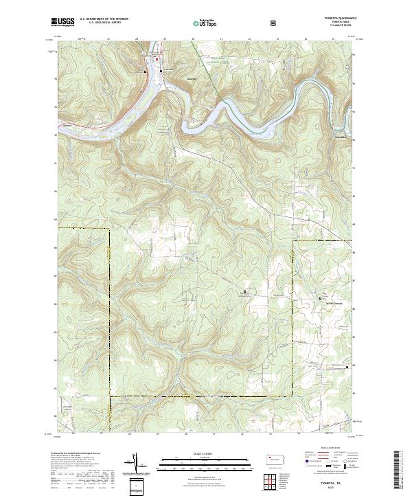
2023 Map of Tionesta
USGS Topo · Published 2023About this map
The Forest County Courthouse serves as the focal point for Tionesta, situated at the confluence of the Allegheny River and Tionesta Creek. This riverine landscape is deeply shaped by the Allegheny National Forest and the protected Allegheny Wild and Scenic River, where the terrain transitions from steep wooded valleys to high plateaus. The map documents a scattered network of rural settlements like Nebraska and Wolfs Corners, connected by winding roads such as Red Brush Rd and State Rte 3001.
Find a feature on this map
75 named features on this map. Tap any name to fly to it.
Don’t see what you’re looking for? This feature index may not catch every label — zoom into the map to look around manually.
Map Details
Editions of this 2023 Tionesta Map
This is the sole edition of this map. No revisions or reprints were ever made.
Other maps of this area

1922 · Oil City
USGS Topo · 1:48,000

1922 · Tionesta
USGS Topo · 1:62,500

1924 · Oil City
USGS Topo · 1:62,500

1924 · Tionesta
USGS Topo · 1:62,500

1927 · Tidioute
USGS Topo · 1:48,000

1927 · Titusville
USGS Topo · 1:62,500

1930 · Tidioute
USGS Topo · 1:62,500

1933 · Titusville
USGS Topo · 1:62,500

1943 · Oil City
USGS Topo · 1:62,500

1946 · Tionesta
USGS Topo · 1:62,500