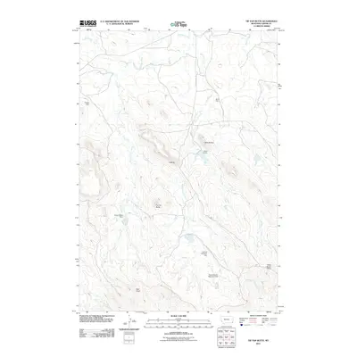
2011 Map of Tip Top Butte
USGS Topo · Published 2011About this map
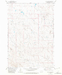
Tip Top Butte rises above a high plains landscape defined by its complex drainage network and prominent geological formations. In this 2011 survey of Carter County, the land is etched by the Clear Fork and Boxelder Creek, alongside smaller tributaries like T L Creek and Duncan Creek. Human engineering in this arid environment is visible through a series of named water management structures, including the Lost Calf Detention Dam, Burch Dam, and Helen B Dent Dam. These features suggest a ranching or agricultural landscape where water retention is critical for survival. The terrain is further distinguished by landforms with evocative names such as Flattops, Twin Buttes, and the isolated Wolf Point to the southwest. Cottonwood RD serves as a primary transit corridor through this section of eastern Montana, connecting these dispersed landmarks across the open range.
Find a feature on this map
21 named features on this map. Tap any name to fly to it.
Don’t see what you’re looking for? This feature index may not catch every label — zoom into the map to look around manually.
Map Details
Editions of this 2011 Tip Top Butte Map
This is the sole edition of this map. No revisions or reprints were ever made.
Other maps of this area

1954 · Ekalaka
USGS Topo · 1:250,000

1956 · Ekalaka
USGS Topo · 1:250,000

1958 · Ekalaka
USGS Topo · 1:250,000

1965 · Ekalaka
USGS Topo · 1:250,000
1970 · Greasy Hill
USGS Topo · 1:24,000

1981 · Alzada
USGS Topo · 1:100,000
1982 · Black Point NE
USGS Topo · 1:24,000
1982 · Whitetail Creek
USGS Topo · 1:24,000

1982 · Phillippi Reservoir
USGS Topo · 1:24,000
1982 · Potato Buttes
USGS Topo · 1:24,000