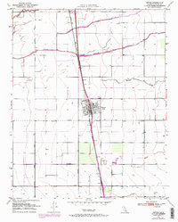
1950 Map of Tipton
USGS Topo · Published 1971About this map
Tipton serves as the central hub of this San Joaquin Valley survey, situated along the dominant corridor of the Southern Pacific railroad. The landscape is defined by the complex hydrology of the Tule River, which splits into the North Branch Tule River and South Branch Tule River as it traverses the agricultural plain. These waterways, along with Mitchell Slough and Elk Bayou, illustrate the critical relationship between the river system and the region's development. Smaller settlements such as Octol, Quail, and Mitchell mark the rail line and surrounding rural sections. The grid-like organization of the valley is evident in the layout of local thoroughfares like Octol Ave and Oakland Colony Road, while the Tipton Cem provides a specific point of interest for those researching local family history.
Find a feature on this map
20 named features on this map. Tap any name to fly to it.
Don’t see what you’re looking for? This feature index may not catch every label — zoom into the map to look around manually.
Map Details
Editions of this 1950 Tipton Map
2 editions found
Other maps of this area

1925 · Tulare
USGS Topo · 1:31,680

1925 · Tipton
USGS Topo · 1:31,680

1927 · Cairns Corner
USGS Topo · 1:31,680

1927 · Lake View School
USGS Topo · 1:31,680

1927 · Paige
USGS Topo · 1:31,680

1927 · Tulare
USGS Topo · 1:31,680

1928 · Tipton
USGS Topo · 1:31,680

1928 · Woodville
USGS Topo · 1:31,680

1929 · Alpaugh
USGS Topo · 1:31,680

1929 · Sausalito School
USGS Topo · 1:31,680