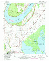
1964 Map of Tiptonville
USGS Topo · Published 1981About this map
The Mississippi River and the complex wetlands of Reelfoot Lake dominate this landscape, illustrating the intricate boundary between Tennessee, Kentucky, and Missouri. This map captures the region at a time when the Illinois Central Gulf railroad served as a primary artery for small agricultural communities like Phillippy and New Markham. The river's historical shifts are evidenced by landforms such as Island No 10 and Winchester Towhead, reflecting the dynamic nature of this alluvial plain.
Find a feature on this map
56 named features on this map. Tap any name to fly to it.
Don’t see what you’re looking for? This feature index may not catch every label — zoom into the map to look around manually.
Map Details
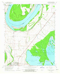
Editions of this 1964 Tiptonville Map
2 editions found
Other maps of this area

1925 · Reelfoot Lake
USGS Topo · 1:62,500

1939 · Reelfoot Lake
USGS Topo · 1:62,500

1939 · Portageville
USGS Topo · 1:62,500

1939 · New Madrid
USGS Topo · 1:62,500

1939 · Bayouville
USGS Topo · 1:62,500

1951 · Bondurant
USGS Topo · 1:24,000

1951 · New Madrid SE
USGS Topo · 1:24,000

1951 · Hubbard Lake
USGS Topo · 1:24,000

1954 · New Madrid
USGS Topo · 1:62,500

1955 · Portageville
USGS Topo · 1:62,500