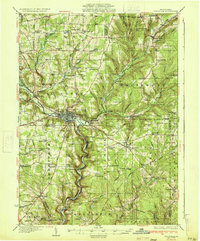
1933 Map of Titusville
USGS Topo · Published 1933About this map
Oil Creek and its many tributaries, such as Caldwell Creek, define this region of Pennsylvania during a period of industrial maturity. This 1933 survey documents the landscape where the American oil industry began, anchored by the landmark Drake Oil Well south of Titusville. The map reveals a dense network of early 20th-century infrastructure, including the Pine Creek Pumping Sta and the Pennsylvania RR corridor through Hydetown. Beyond the industrial centers, the map is a genealogical goldmine of rural settlements and family-named intersections like Mageetown Corners and Rendalls Corners. Public life is well-represented by numerous country schools such as Fink Ridge Sch and Cattaraugus Sch, alongside community hubs like the Good Will Town Hall. The presence of Fieldmore Park and Shelmadine Springs suggests a era when local recreation and natural springs were integral to the social fabric of the Crawford and Venango county lines.
Find a feature on this map
140 named features on this map. Tap any name to fly to it.
Don’t see what you’re looking for? This feature index may not catch every label — zoom into the map to look around manually.
Map Details
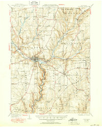
Editions of this 1933 Titusville Map
3 editions found

Other maps of this area

1909 · Franklin
USGS Topo · 1:62,500

1911 · Franklin
USGS Topo · 1:62,500

1922 · Oil City
USGS Topo · 1:48,000

1922 · Tionesta
USGS Topo · 1:62,500

1924 · Oil City
USGS Topo · 1:62,500

1924 · Tionesta
USGS Topo · 1:62,500

1926 · Youngsville
USGS Topo · 1:62,500

1927 · Townville
USGS Topo · 1:48,000

1927 · Tidioute
USGS Topo · 1:48,000

1927 · Titusville
USGS Topo · 1:62,500