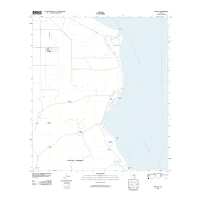
2010 Map of Tivoli SE
USGS Topo · Published 2010About this map
Blackjack Peninsula dominates this coastal landscape, stretching into the meeting point of Hynes Bay and San Antonio Bay. The terrain is defined by its relationship with the water, featuring prominent landforms such as McDowell Point, Webb Point, and Dagger Point. Inland, the map reveals an extensive network of named water-drawing sites, including Buzzard Windmill, Venada Windmill, and Salado Windmill, which suggest the vital importance of groundwater for cattle ranching or agriculture in this coastal environment.
Find a feature on this map
26 named features on this map. Tap any name to fly to it.
Don’t see what you’re looking for? This feature index may not catch every label — zoom into the map to look around manually.
Map Details
Editions of this 2010 Tivoli SE Map
This is the sole edition of this map. No revisions or reprints were ever made.
Other maps of this area

1952 · Mosquito Point
USGS Topo · 1:24,000

1952 · St. Charles Bay
USGS Topo · 1:24,000

1952 · Tivoli
USGS Topo · 1:24,000

1952 · Mesquite Bay
USGS Topo · 1:24,000

1952 · Tivoli SE
USGS Topo · 1:24,000

1952 · Panther Point
USGS Topo · 1:24,000

1952 · Austwell
USGS Topo · 1:24,000

1952 · Seadrift
USGS Topo · 1:24,000

1952 · Tivoli SW
USGS Topo · 1:24,000

1953 · Beeville
USGS Topo · 1:250,000